


Beskrivning
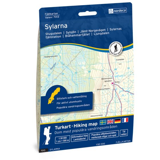
Sylarna Swedish hiking map
Covers popular hiking areas with highlighted hiking information
The map covers Stugudalen, Ljungdalen, Neabyen
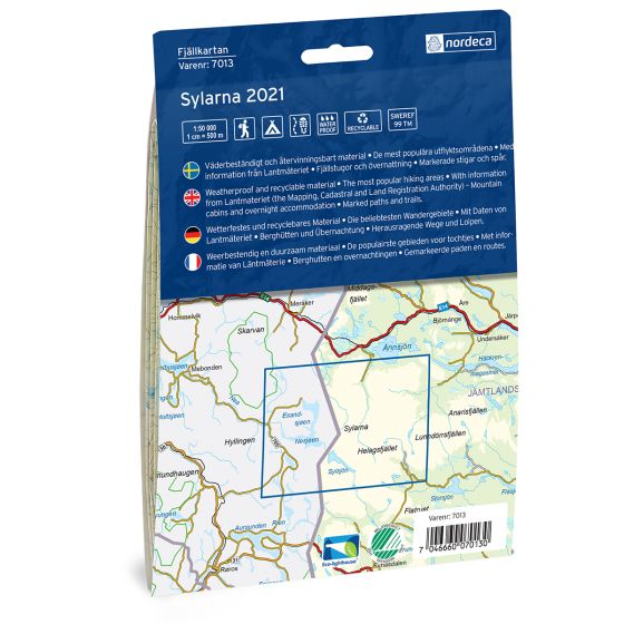
Scale 1:50 000 in water resistant material
Sök på typ av produkt, artikelnummer eller dylikt och tryck på enter.
Det ursprungliga priset var: 349,00 kr.314,10 krDet nuvarande priset är: 314,10 kr.
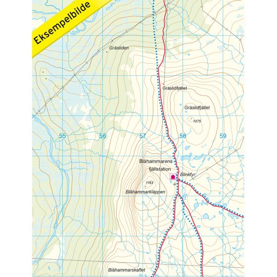
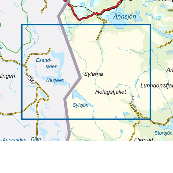
Mountain map Sylarna is a detailed map that covers more than 3000 km2. This includes trails, mountain lodges and cabins in the area, which are clearly marked on the map. The map covers Sylarna, on both the Norwegian and the Swedish side of the national border. This mountain region is almost unpopulated, with splendid natural beauty, well-marked hiking and skiing trails, and high mountain peaks. It also has numerous mountain cabins to visit. The peak trip up to Storsylen (1762 msl), is the most popular route in the area. The Nedal cabin in Tydal is a great starting point for this trip and many other fantastic mountain hikes and ski trips in the Syl massif. The map also covers the Blåhammaren mountain station, which is part of the classic hiking trail past the four visitor points in Sylarna. On this trail, you will pass the Nedal cabin, Sylarna mountain station, the Blåhammar mountain station, and finally Storerikvollen on the Norwegian side. The map also covers the Lungedalen region, southeast of Sylan. The place is a popular starting point for cross-country skiers. Mountain lodges and cabins are located on the map at the following sites: Nedal, Storerikvollen (Norwegian side), Sylarnas mountain station, Blåhammaren mountai station, Storulvåns mountain station, Stensdals, Gåsen, Vålå, Helags mountain station and Ljungdalen.
Brand Nordeca Konsument
SKU 7013
Ean 704660070130
Map usage Hiking, Cross Country
Series Swedish Mountain Map
Language English, German, Dutch, Swedish
Map both sides Yes
Format Foldable
Destinations Stugudalen, Ljungdalen, Storøvlingen, Løvøya, Neabyen, Ås, Stensdalen, Nyhemmen,
Accommodation Cabins
Country Sweden
Material Plastic fiber
Trails Hiking trails
Scale 1: 50 000
Map size 70×100 cm
Sylarna Swedish hiking map
Covers popular hiking areas with highlighted hiking information
The map covers Stugudalen, Ljungdalen, Neabyen
Scale 1:50 000 in water resistant material
Betala med:


Snabba leveranser över hela Europa
Betala med Swish, faktura eller Klarna med mera
Leverans hem till dörren